
Great Rides — The Bike Shop, Redding, CA

Redding’s riding scene will have you California dreaming

Redding is hard to beat for great riding of every variety. That's why we're here to help guide you to the cream of the cycling crop with our curated list of routes vetted by our shop staff and awesome customers!

Nestled within the scenic Shasta Cascade region, Redding gives road, mountain, and gravel riders alike a chance to get in some epic elevation gains. Gravel riders looking to explore miles of unpaved paradise can enjoy grit and good times in Shasta-Trinity National Forest or Lassen National Forest, while trail tamers searching for off-road adventures have access to an entire mecca of mountain biking thanks to the Redding Trail Alliance. And if it's a scenic paved route you're after, a popular northern ride over the Shasta Dam delivers a stunning cruise for any road warrior. 

For those who like to keep it casual, the Sacramento River Trail, running alongside its namesake and into the center of downtown, is the perfect route to enjoy a relaxing spin with the whole family. Add over 300 days of sunshine, and it's clear to see why cyclists are always sporting a grin while rolling around Redding.

Ready to begin exploring? Discover your new favorite route below and be sure to swing by the shop afterward to let us know what you think! 

Our most popular road rides

Shasta KOA to Weed and Back

Distance: 28.1 mi

Elevation: +/- 1787 ft

Mount Shasta, CA

Old Shasta

Distance: 30.8 mi

Elevation: +/- 1643 ft

Redding, CA

Shasta Dam

Distance: 36.1 mi

Elevation: +/- 1791 ft

Redding, CA

Palo Cedro to Whitmore

Distance: 47.8 mi

Elevation: +/- 3030 ft

Palo Cedro, CA

Anderson to Dry Creek to Millville Plains

Distance: 57.6 mi

Elevation: +/- 1526 ft

Shasta County, CA

Fall River Classic

Distance: 66.4 mi

Elevation: +/- 2651 ft

McArthur, CA

Viola to Lassen Park Out and Back

Distance: 70.5 mi

Elevation: +/- 7468 ft

Shasta County, CA

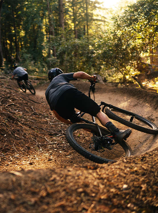
Our most popular mountain rides

Enticer

Distance: 1 mi

Swasey Recreational Area
Intersection of Neilson Way/Delano Dr
Redding, CA 96001

CC Ditch Trail

Distance: 2 mi

Swasey Recreational Area
End of Delano Dr
Redding, CA 96001

Hornbeck and Lower Sacramento Ditch Trail

Distance: 6 mi

Hornbeck Trailhead
12086 Quartz Hill Rd
Redding, CA 96003

Princess Ditch

Distance: 8 mi

Oak Knoll Trailhead
8186 Muletown Rd
Redding, CA 96001

Westside Trails

Distance: 12 mi

Upper Salt Creek Trailhead
Valparaiso Way
Redding, CA 96001

Mule Ridge and Swasey Recreation Area

Distance: 44 mi

Swasey Recreational Area
Redding, CA 96001

Keswick

Distance: 27 mi

Middle Creek Connector
Trailhead Parking 16661 Eureka Way
Redding, CA 96001

Whiskeytown

Distance: 73 mi

Shasta Bally Parking Lot
Shasta County, CA

Our most popular family rides

Clover Creek Preserve

Distance: 1.6 mi

Elevation: +/- 17 ft

Redding, CA

Arboretum Loop Trail

Distance: 1.9 mi

Elevation: +/- 55 ft

Redding, CA

Turtle Bay and Arboretum Loops

Distance: 3.2 mi

Elevation: +/- 80 ft

Redding, CA

Churn Creek Greenway

Distance: 3.7 mi

Elevation: +/- 180 ft

Redding, CA

Our most popular gravel rides

South Fork Lookout

Distance: 12.7 mi

Elevation: +/- 1976 ft

Shasta County, CA

West Prospect Peak

Distance: 23.1 mi

Elevation: +/- 3585 ft

Shasta County, CA

Chester Gravel

Distance: 41.6 mi

Elevation: +/- 2062 ft

Tehama County, CA

We’re here to help you find a great local ride - give us a call or stop by today.